La Guida Turistica del Pianeta Terra: un'esilarante avventura dalla Namibia alla Liguria!

La Guida Turistica del Pianeta Terra: un'esilarante avventura dalla Namibia alla Liguria!
La Guida Turistica del Pianeta Terra: un'esilarante avventura dalla Namibia alla Liguria!


The Mount Vestius over 2000 meters of altitude and stands out on Lake Garda by giving superlative views: There are several itineraries to reach it and on this page we describe the fastest and most panoramic rather.
The Mount Vestimo is located in the same Monte Baldo mountain range, on the east coast of Lake Garda. For those in the northern part of the lake (in Riva del Garda or in Torbole) to reach the summit with the path below is very comfortable.

Here the dirt road continues, but it is barred and not passable by car. Mountain bike and e-bike enthusiasts can continue along the dirt road, while for walking hikers there is a shorter path that cuts the road at various points.


Thus we arrive at a large lawn, where an information sign describes the itinerary. There is a cross between different paths, and the shortest for the highest mountain is also the most obvious one, which goes up to the coast along the grassy slopes of Mount Varagna.


After passing the path in the meadow, then the last trait of ascent on a rocky bottom, with the views of the Garda that becomes more and more open and fascinating! An important advice to deal with this walk, especially on summer weekends, is to start relatively early, maximum at 9 am from Torbole. Thus, in fact, it is better located (the Stanga car park is a small dirt area, you can invent other parking lots along the way but the spaces are not so many), you walk when it is not too hot and above all you can enjoy the views with the Limpid morning air.


On the very high mountain there are also some trenches/fortifications of the First World War, to complete the one that is one of the most beautiful walks of Garda Northern.

If you like outdoor activities and adventurous trips or if you want to find more photos of this and other destinations, as well as advice and new itineraries, Visit our FB page and put it like:
Share this page with your friends:

Have you put it on our FB page?
Click here For an overview of the trekking in Italy
.JPG)
Among the many paths described, other excursions on Lake Garda, including The itinerary panoramic towards Cima Comer , the itineraries Towards strong and trenches around a Torbole , the beautiful Ponale path that can continue with The panoramic great tip larchi and easy Walk from Lazise to Bardolino . To change lake, not too far away there is this Bel Trail on Lake Iseo .
We can also recommend a tide of Trails In Liguria , tried and testified.
Here are some travel diary also with a trekking theme, full of ideas and photos:
.JPG)
Iceland
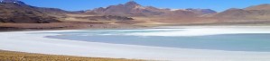
Chile and Patagonia Argentina
we go away, in authentic hiking paradises, with itineraries from deserts to glaciers
.JPG)
France and Spain in Camper - Photos and travel itinerary
Follie to Pamplona, Surf on the Atlantic and Kayak in the Ardèche
.JPG)
Norway - Photos and travel itinerary
Warming by car between fjords, highlands and ice lakes, in admire Contemplation
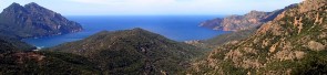
Corsica - Photos and travel itinerary
a wild island at your fingertips, ideal for hiking itineraries, with crystal clear sea and steep mountains
.JPG)
Crete - Photos and travel routes trekking on trails overlooking the sea, off-road and sailing: a wild approach to a spectacular Greek island
Discover Here The tourist guide of the Planet Earth , the richest, exciting and ironic guide on the whole world.
contact info@wildrips.net Click on a route, suggestions on a travel diary, collaborations or to organize trips at sea in Liguria.
Site map - Privacy